


 The Town of St. Michaels has made substantial investments into our antiquated water department infrastructure and billing system. We are pleased to announce as part of these upgrades, we have integrated an electronic bill payment option for all Town water customers. Water customers will now have multiple options for paying their bills; i.e. electronic, check, cash, or money order payments.
If you are interested in utilizing the electronic payment option please use the link and instructions below.
Link to the portal to pay your water bill:
https://wipp.edmundsassoc.com/Wipp/?wippid=STMT
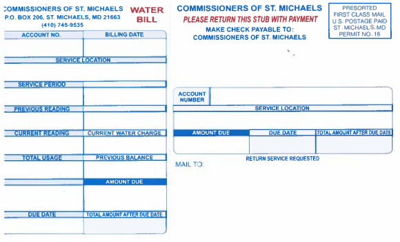
The utility account ID and utility account pin is located on the return stub of your water bill (it will be right above your address).
You can choose to register as a new user or simply put your information in the utility account information box and follow the steps.
You will receive an email confirmation once payment is received.
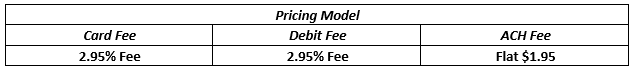
View the fee schedule applied by the vendor when utilizing a credit card, debit card, or echeck/ACH.
At this time autopay is not an option.
To receive your water bill electronically:
If you prefer to receive your water bills electronically, we ask you contact our office at the number below and provide us your email information. After registering, you should receive your next water bill electronically.
If you have any questions, please contact Vickie Sharp, in our Water Department, at 410-745-9535.